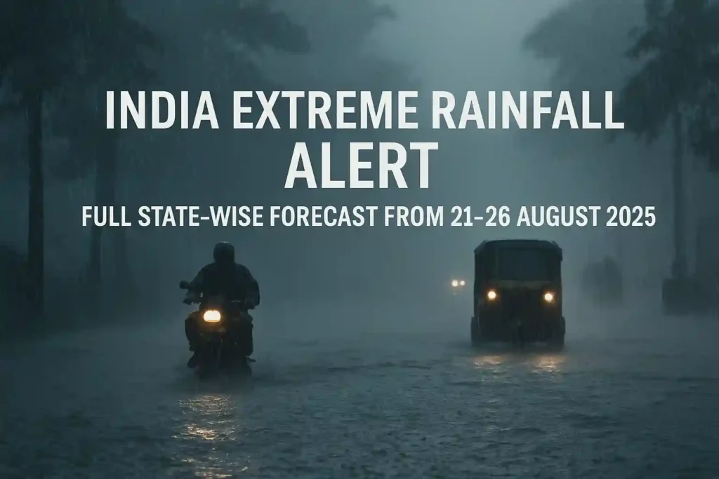
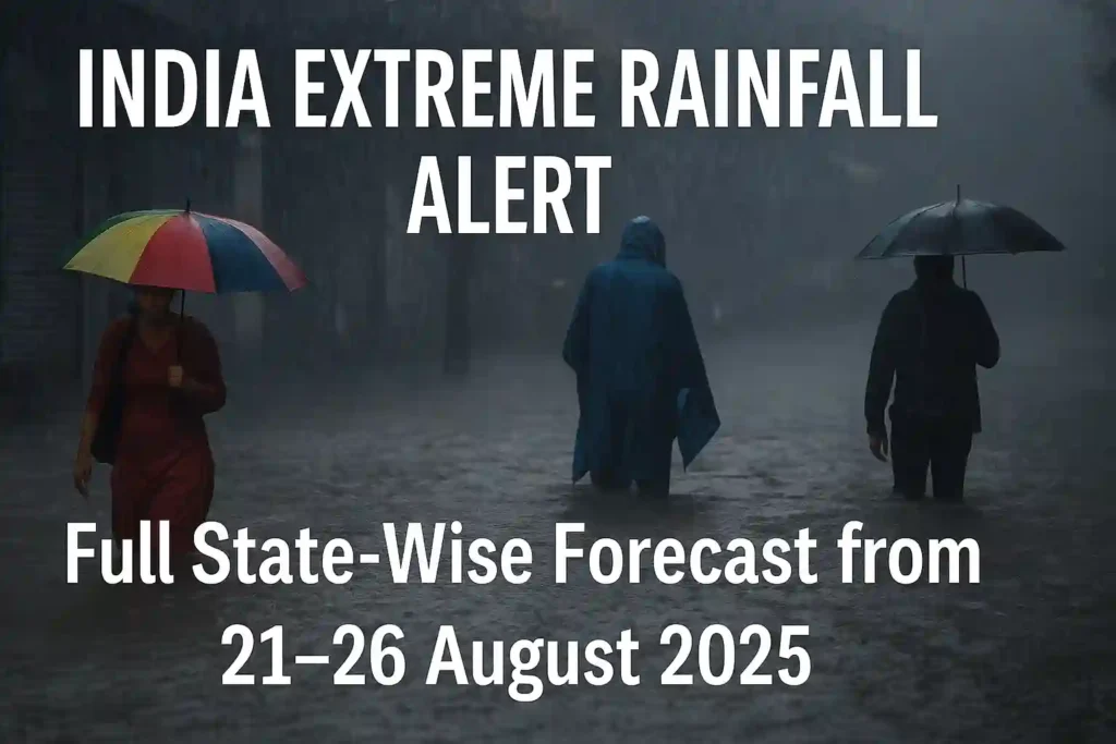
The skies haven’t stopped crying over India, and what started as intense monsoon showers three days ago has now become a full-blown weather emergency.
As of today, August 21st, 2025, massive parts of the country are drowning under relentless rainfall that’s showing no signs of stopping.
Picture this: Mumbai has logged its wettest August in five years – recording 837.3 mm of rain in just five-and-a-half days.
That’s not just heavy rain — that’s the kind of downpour that makes streets look like rivers and turns commutes into survival challenges.
When It All Began
The trouble started brewing around August 18-19th when a low-pressure system from the Bay of Bengal began its destructive march across western India.
The Timeline of Destruction:
- August 18th: Coastal Andhra Pradesh, south Chhattisgarh, south Odisha hit first
- August 18-19th: Konkan (including Mumbai), Goa, coastal Karnataka pounded
- August 19-20th: Gujarat state comes under siege
What started as orange alerts quickly escalated to red warnings as the weather system intensified far beyond what meteorologists initially predicted.
Bottom line: This wasn’t supposed to be this bad. But nature had other plans.
The Current Crisis: August 21st
Today, several regions are in the eye of the storm.
Mumbai — India’s financial capital — is practically underwater.
The Mumbai Nightmare:
- Local trains: Running but with major delays due to flooded tracks
- Schools: Completely shut across the city and neighboring districts
- Flights: Massive delays at Chhatrapati Shivaji International Airport
- Streets: Knee-deep water forcing people to wade through floods
- Monorail disaster: Over 400 passengers stranded for hours after power failure
The city’s lifeline — its suburban railway network — is struggling badly.
This isn’t just an inconvenience anymore. It’s becoming dangerous.
Reports are coming in of people getting trapped in railway stations, cars floating down roads, and emergency services stretched to their limits.
Gujarat Under Siege
Meanwhile, Gujarat’s Saurashtra region is bearing the brunt of what the IMD calls “exceptionally heavy rainfall.”
The Numbers Are Staggering:
- Warning Level: Red Alert for Saurashtra & Kutch
- Expected Rainfall: Up to 30 cm in single day (that’s nearly a foot!)
- Current Impact: Villages flooded, evacuations underway
- Timeline: Continuing through August 21st
Let me put 30 cm in perspective:
That’s enough water to flood ground floors of buildings and make roads completely impassable. We’re talking about water levels that can literally sweep away cars.
The Saurashtra region has never seen anything like this in recent memory.
What’s Coming Next: The 5-Day Nightmare
The IMD’s forecast for August 22-26 reads like a disaster warning.
The rain is spreading like wildfire across central and northern India:
Bihar & Jharkhand (August 22-24):
- Heavy continuous rainfall with serious flooding risks
- Lightning warnings — farmers should avoid fieldwork completely
- River levels rising — expect major disruption
Uttarakhand & Himachal Pradesh (August 22-25):
- Double threat: Heavy rain + landslide risk
- Mountain roads could become death traps
- Cloudburst possibility in higher altitudes
Punjab, Haryana, UP, Rajasthan, Chhattisgarh:
- Rain belt expanding rapidly through these states
- Thunderstorms expected with lightning risk
North-East (Assam, Meghalaya, Arunachal Pradesh):
- Heavy spells continuing until at least August 24th
- Flash flood warnings for low-lying areas
The pattern is clear: This weather monster is just getting started.
Understanding the Alerts: What They Really Mean
Let me break down the IMD’s color-coded warning system in plain English:
🔴 Red Alert = Drop everything and take action NOW
Extremely heavy rainfall expected, major disruption likely
🟠 Orange Alert = Be prepared
Heavy rain coming, keep emergency plans ready
🟡 Yellow Alert = Stay alert
Weather could turn nasty, monitor updates
When the IMD says some regions might get 30 cm rainfall in one day, they’re talking about potentially catastrophic flooding.
Translation: If you’re in a red alert zone, don’t take chances. Period.
This is not a drill. This is not routine monsoon weather.
Staying Safe: Practical Advice
This isn’t your regular monsoon shower. Here’s what you need to know:
🚫 AVOID FLOODED STREETS AT ALL COSTS
That knee-deep water you see? It could hide manholes, electrical hazards, or swift currents that can sweep you away.
🏔️ STAY AWAY from rivers and coastal areas during heavy spells
Water levels can rise frighteningly fast during extreme rainfall events like this.
👨🌾 FARMERS in Bihar/Jharkhand: This is NOT the time to be working in the fields
Lightning strikes during thunderstorms are real and deadly. Your crops can wait — your life cannot.
🚗 MOUNTAIN TRAVEL is a no-go right now
Landslides don’t give warnings, and cloudburst floods can appear out of nowhere in hilly terrain.
⚡ During thunderstorms: UNPLUG your electronics and stay indoors
Lightning-related accidents spike during intense weather like this.
📱 KEEP YOUR PHONE CHARGED and have backup power sources ready.
The golden rule: When in doubt, don’t go out.
The Bigger Picture
The human cost is already mounting.
Death Toll Rising:
- 10 people killed in Maharashtra alone due to rain-related incidents
- Multiple casualties reported from Gujarat’s flooding
- Rescue operations ongoing across affected states
Agricultural Devastation:
- More than 15 lakh acres of farmland damaged across Maharashtra
- 17 districts in Marathwada, Vidarbha, and Western Maharashtra worst hit
- Food prices likely to spike in coming weeks
Infrastructure Under Siege:
- Mumbai’s suburban trains — lifeline for millions — severely disrupted
- Flight operations hit at major airports
- Power outages reported across multiple cities
This isn’t just about inconvenience anymore — this extreme weather is turning lethal.
When this much farmland gets damaged, it affects food prices and farmer livelihoods for months to come.
The ripple effects will be felt long after the rains stop.
Critical Days Ahead
Make no mistake: the next 5-7 days are going to be critical.
This isn’t routine monsoon behavior. The sheer scale, intensity, and duration of this rainfall event is exceptional.
Key Points to Remember:
🌧️ Multiple states under simultaneous red/orange alerts
🌊 Saturated soils can’t absorb more water — flooding guaranteed
🏞️ Overflowing rivers across western and central India
🏗️ Infrastructure pushed to breaking point
⚰️ Death toll rising — this is becoming deadly
The weather pattern shows no signs of backing down quickly.
What makes this different?
- Unprecedented rainfall intensity in multiple regions simultaneously
- Longer duration than typical monsoon spells
- Earlier than usual peak monsoon activity
- Geographic spread covering nearly half the country
BOTTOM LINE: Stay informed, stay safe, and take the warnings seriously. This is one of those times when being overly cautious isn’t being dramatic — it’s being smart.
Weather events like this remind us how powerful nature can be. The best thing we can do right now is respect that power and prioritize safety over everything else.
Stay updated with local authorities and emergency services. This situation is evolving rapidly.
भारत में चरम बारिश की चेतावनी: मानसून बना जानलेवा
आसमान रो रहा है और रुकने का नाम नहीं ले रहा। जो बारिश तीन दिन पहले शुरू हुई थी, वो अब एक खतरनाक मौसमी आपातकाल का रूप ले चुकी है।
आज 21 अगस्त 2025 तक, देश के बड़े हिस्से ऐसी बेरहम बारिश में डूब गए हैं जिसका अंत दिखाई नहीं दे रहा।
सिर्फ एक आंकड़ा देखिए: मुंबई में पिछले 5 साल की सबसे भारी अगस्त की बारिश हुई है – सिर्फ साढ़े 5 दिनों में 837.3 मिमी बारिश।
यह सिर्फ बारिश नहीं है — यह वो तूफान है जो सड़कों को नदी बना देता है और आपके सफर को जीवन-मृत्यु की लड़ाई में बदल देता है।
कब शुरू हुई यह तबाही
मुसीबत 18-19 अगस्त के आसपास शुरू हुई जब बंगाल की खाड़ी से एक कम दबाव का क्षेत्र पश्चिमी भारत की तरफ बढ़ा।
तबाही का टाइमलाइन:
- 18 अगस्त: तटीय आंध्र प्रदेश, दक्षिणी छत्तीसगढ़, दक्षिणी ओडिशा पहले मार झेली
- 18-19 अगस्त: कोंकण (मुंबई सहित), गोआ, तटीय कर्नाटक की बुरी हालत
- 19-20 अगस्त: गुजरात राज्य घेराबंदी में आ गया
जो नारंगी अलर्ट से शुरू हुआ था, वो जल्दी ही लाल चेतावनी में बदल गया क्योंकि मौसम का सिस्टम अनुमान से कहीं ज्यादा खतरनाक हो गया।
साफ बात: इतना बुरा होने वाला नहीं था। लेकिन प्रकृति के अपने इरादे थे।
आज की स्थिति: 21 अगस्त
आज कई इलाके तूफान के बीचोबीच हैं।
मुंबई — भारत की आर्थिक राजधानी — लगभग पानी के नीचे है।
मुंबई का दुःस्वप्न:
- लोकल ट्रेनें: चल रही हैं लेकिन भरे पटरियों की वजह से भारी देरी
- स्कूल: शहर और आसपास के जिलों में पूरी तरह बंद
- फ्लाइट्स: छत्रपति शिवाजी अंतर्राष्ट्रीय हवाईअड्डे पर भारी देरी
- सड़कें: घुटने भर पानी, लोग बाढ़ में तैर कर निकल रहे
- मोनोरेल हादसा: बिजली गुल होने से 400+ यात्री घंटों तक फंसे रहे
शहर की जीवनरेखा — उपनगरीय रेल नेटवर्क — बुरी तरह परेशान है।
यह अब सिर्फ परेशानी नहीं है। यह खतरनाक हो रहा है।
रिपोर्ट्स आ रही हैं कि लोग रेलवे स्टेशनों में फंस गए हैं, कारें सड़कों पर तैर रही हैं, और आपातकालीन सेवाएं अपनी सीमा पार कर गई हैं।
गुजरात की घेराबंदी
इस बीच, गुजरात का सौराष्ट्र क्षेत्र उस चीज़ का सामना कर रहा है जिसे IMD “असाधारण भारी बारिश” कहता है।
आंकड़े चौंकाने वाले हैं:
- चेतावनी स्तर: सौराष्ट्र और कच्छ के लिए लाल अलर्ट
- अनुमानित बारिश: एक दिन में 30 सेमी तक (यानी लगभग एक फुट!)
- वर्तमान प्रभाव: गांव बाढ़ में, लोगों को निकाला जा रहा
- समयसीमा: 21 अगस्त तक जारी
30 सेमी का मतलब समझिए:
यह इतना पानी है कि इमारतों की निचली मंजिलें बाढ़ में आ जाएं और सड़कें पूरी तरह अगम्य हो जाएं। हम बात कर रहे हैं उस पानी के स्तर की जो सचमुच कारों को बहा ले जा सकता है।
सौराष्ट्र क्षेत्र ने हाल की स्मृति में ऐसा कुछ नहीं देखा है।
आगे क्या आने वाला है: 5 दिन का दुःस्वप्न
22-26 अगस्त के लिए IMD का पूर्वानुमान एक आपदा चेतावनी की तरह लगता है।
बारिश मध्य और उत्तरी भारत में जंगल की आग की तरह फैल रही है:
बिहार और झारखंड (22-24 अगस्त):
- लगातार भारी बारिश गंभीर बाढ़ के जोखिम के साथ
- बिजली गिरने की चेतावनी — किसानों को खेतों का काम पूरी तरह बंद कर देना चाहिए
- नदियों का जलस्तर बढ़ रहा — बड़े व्यवधान की उम्मीद
उत्तराखंड और हिमाचल प्रदेश (22-25 अगस्त):
- दोहरा खतरा: भारी बारिश + भूस्खलन का जोखिम
- पहाड़ी सड़कें मौत के जाल बन सकती हैं
- ऊंचाई वाले इलाकों में बादल फटने की संभावना
पंजाब, हरियाणा, यूपी, राजस्थान, छत्तीसगढ़:
- इन राज्यों में बारिश का पट्टा तेज़ी से फैल रहा
- बिजली गिरने के जोखिम के साथ गर्जना-तर्जना की उम्मीद
उत्तर-पूर्व (असम, मेघालय, अरुणाचल प्रदेश):
- कम से कम 24 अगस्त तक भारी बारिश जारी
- निचले इलाकों के लिए अचानक बाढ़ की चेतावनी
पैटर्न साफ है: यह मौसमी राक्षस अभी शुरुआत कर रहा है।
चेतावनियों को समझें: इनका वास्तव में क्या मतलब है
आइए IMD की रंग-कोडेड चेतावनी प्रणाली को सादी भाषा में समझाते हैं:
🔴 लाल अलर्ट = सब कुछ छोड़कर अभी एक्शन लें
अत्यधिक भारी बारिश की उम्मीद, बड़ा व्यवधान संभावित
🟠 नारंगी अलर्ट = तैयार रहें
भारी बारिश आ रही है, आपातकालीन योजनाएं तैयार रखें
🟡 पीला अलर्ट = सचेत रहें
मौसम खराब हो सकता है, अपडेट पर नज़र रखें
जब IMD कहता है कि कुछ क्षेत्रों में एक दिन में 30 सेमी बारिश हो सकती है, तो वे संभावित विनाशकारी बाढ़ की बात कर रहे हैं।
अनुवाद: अगर आप लाल अलर्ट ज़ोन में हैं, तो जोखिम न लें। बिल्कुल नहीं।
यह कोई ड्रिल नहीं है। यह आम मानसूनी मौसम नहीं है।
सुरक्षित रहें: व्यावहारिक सलाह
यह आपका आम मानसूनी बौछार नहीं है। यहाँ है आपको जो जानना चाहिए:
🚫 बाढ़ वाली सड़कों से बिल्कुल बचें
जो घुटने भर पानी दिख रहा है? उसमें मैनहोल, बिजली के खतरे, या तेज़ धारा छुपी हो सकती है जो आपको बहा ले जा सकती है।
🏔️ नदियों और तटीय इलाकों से दूर रहें भारी बारिश के दौरान
इस तरह की चरम बारिश में पानी का स्तर डरावनी तेज़ी से बढ़ सकता है।
👨🌾 बिहार/झारखंड के किसान: अभी खेतों में काम करने का समय बिल्कुल नहीं है
आंधी-तूफान में बिजली गिरना वास्तविक और जानलेवा है। आपकी फसल इंतज़ार कर सकती है — आपकी जान नहीं।
🚗 पहाड़ी यात्रा अभी नो-गो ज़ोन है
भूस्खलन कोई चेतावनी नहीं देते, और पहाड़ी इलाकों में बादल फटने की बाढ़ कहीं से भी आ सकती है।
⚡ आंधी-तूफान के दौरान: अपने इलेक्ट्रॉनिक्स अनप्लग करें और घर के अंदर रहें
इस तरह के तीव्र मौसम में बिजली गिरने की दुर्घटनाएं बढ़ जाती हैं।
📱 अपना फोन चार्ज रखें और बैकअप पावर स्रोत तैयार रखें।
गोल्डन रूल: संदेह होने पर, बाहर न निकलें।
बड़ी तस्वीर
इंसानी कीमत पहले से ही बढ़ रही है।
मृत्यु का आंकड़ा बढ़ रहा:
- अकेले महाराष्ट्र में बारिश संबंधी घटनाओं में 10 लोगों की मौत
- गुजरात की बाढ़ से कई हताहत की रिपोर्ट
- प्रभावित राज्यों में बचाव अभियान जारी
कृषि तबाही:
- महाराष्ट्र में 15 लाख एकड़ से ज्यादा खेत क्षतिग्रस्त
- मराठवाड़ा, विदर्भ और पश्चिमी महाराष्ट्र के 17 जिले सबसे बुरी तरह प्रभावित
- आने वाले हफ्तों में खाद्य कीमतों में वृद्धि की संभावना
इन्फ्रास्ट्रक्चर की घेराबंदी:
- मुंबई की उपनगरीय ट्रेनें — लाखों की जीवनरेखा — गंभीर रूप से बाधित
- प्रमुख हवाईअड्डों पर फ्लाइट संचालन प्रभावित
- कई शहरों में बिजली कटौती की रिपोर्ट
यह अब सिर्फ असुविधा की बात नहीं है — यह चरम मौसम जानलेवा हो रहा है।
जब इतनी खेती को नुकसान होता है, तो इसका असर महीनों तक खाद्य कीमतों और किसानों की आजीविका पर पड़ता है।
बारिश रुकने के बाद भी इसके प्रभाव लंबे समय तक महसूस होंगे।
आगे के महत्वपूर्ण दिन
गलती न करें: अगले 5-7 दिन बहुत महत्वपूर्ण होने वाले हैं।
यह सामान्य मानसूनी व्यवहार नहीं है। इस बारिश की घटना का पैमाना, तीव्रता और अवधि असाधारण है।
याद रखने योग्य मुख्य बातें:
🌧️ कई राज्य एक साथ लाल/नारंगी अलर्ट के तहत
🌊 संतृप्त मिट्टी और पानी को अवशोषित नहीं कर सकती — बाढ़ गारंटीड
🏞️ पश्चिमी और मध्य भारत में नदियों का अतिप्रवाह
🏗️ इन्फ्रास्ट्रक्चर टूटने के कगार पर
⚰️ मृत्यु दर बढ़ रही — यह जानलेवा हो रहा है
मौसम पैटर्न जल्दी शांत होने के कोई संकेत नहीं दे रहा।
यह अलग क्यों है?
- एक साथ कई क्षेत्रों में अभूतपूर्व बारिश की तीव्रता
- सामान्य मानसूनी अवधि से ज्यादा लंबी अवधि
- सामान्य से पहले आने वाली चरम मानसूनी गतिविधि
- लगभग आधे देश को कवर करने वाला भौगोलिक फैलाव
निष्कर्ष: जानकारी में रहें, सुरक्षित रहें, और चेतावनियों को गंभीरता से लें। यह उन समयों में से एक है जब अत्यधिक सतर्क होना नाटकबाजी नहीं है — यह समझदारी है।
इस तरह की मौसमी घटनाएं हमें याद दिलाती हैं कि प्रकृति कितनी शक्तिशाली हो सकती है। अभी हम जो सबसे अच्छा कर सकते हैं वो है उस शक्ति का सम्मान करना और हर चीज़ से ऊपर सुरक्षा को प्राथमिकता देना।
स्थानीय अधिकारियों और आपातकालीन सेवाओं के साथ अपडेटेड रहें। यह स्थिति तेज़ी से बदल रही है।